Our Services
Aerial Photography
Capture high-resolution aerial photos that showcase every property’s scale, layout, and surroundings with exceptional clarity. Perfect for real estate, development, and environmental documentation, turning visuals into data-driven insights that attract buyers and strengthen project presentations.
Videography
Deliver cinematic 4K aerial videos that tell your project’s story from a powerful new perspective. From construction progress to real estate showcases, our drone videography captures detail, motion, and scale to engage clients, investors, and communities with stunning precision.
Aerial Inspections
Get precise, high-quality aerial imagery for roof inspections, high-liability safety assessments, and environmental monitoring all without putting workers at risk. We deliver efficient, cost-effective visuals that enhance compliance, maintenance, and project oversight.
3D Mapping
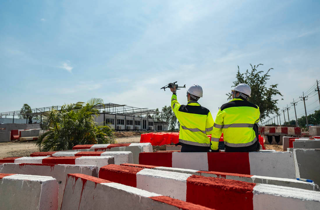
Capture precise aerial data to generate detailed orthomosaic maps and 3D visual models of construction sites, land parcels, and environmental projects. Our mapping workflow delivers accurate measurements, surface analysis, and volumetric insights, helping teams plan smarter, track progress, and meet compliance goals safely and efficiently.
Photo + Video Bundle — starting as low at $150
Capture precision aerial data. Our bundle combines high-resolution aerial photography with cinematic 4K drone footage to document every angle of your property or project with accuracy and impact. Ideal for real estate listings, land development, and high-liability inspection sites — we help you show progress, verify conditions and present assets confidently while reducing on-site risk and time. This bundle includes 10–15 high-resolution aerial photos and 30 seconds to 1 minute of edited 4K video with professional color correction.
We highlight key site features — boundaries, access points, and layout — and deliver your visuals via a secure download link with presentation-ready files.
Call for a custom quote.

